Is the Towpath Fully Open Again? Fall Walks and Bike Loops Around Yardley
October 15, 2026
October 15, 2026
For five years, a towpath outing from Yardley meant walking or riding north, picking a turnaround and coming back the same way. Tropical Storm Ida hit Pennsylvania in September 2021, and the upriver damage was severe. The Lumberville Aqueduct was so undermined that it had to be removed. At High Falls Creek, the storm washed out a culvert pipe and the towpath with it.
In its Summer 2026 newsletter, dated August 17, the Friends of the Delaware Canal reported that both projects are finished. The towpath is clear from Bristol to Easton, with one break in New Hope. The same newsletter lists a set of loop routes that cross the Delaware into New Jersey and come back. Two of those loops begin around Yardley and Lower Makefield.
This fall the towpath near Yardley works best as a set of loops, and the one bridge in the region built for riding straight across holds those loops together.
Most of the repairs were far upriver. DCNR and other agencies spent five years redesigning the Lumberville and High Falls structures to hold up against stronger storms. With those done, the newsletter suggests walks from Lumberville to Point Pleasant and bike rides past the Homestead General Store in Upper Black Eddy onto the new High Falls section.
The break in New Hope is at milepost 23.7, by the Union Mills Bridge and the Water Works Condominiums. The closure notice says the bridge and the towpath beneath it are closed until further notice because of disrepair and the risk of falling debris. That notice dates to March 25, 2025. It is still posted on DCNR's Delaware Canal State Park alerts page, so check that page before riding north through New Hope.
Water levels are a separate question from the trail. In a statement the New Hope Free Press carried in June, the Friends said they discovered on April 23, 2026, that debris had knocked over the Centre Bridge pump that feeds the canal. After three weeks, the canal in New Hope had drained, and a temporary pump was put in while the original was repaired. The Fall 2026 newsletter, dated October 8, reports that the repaired pump went back in on September 18.
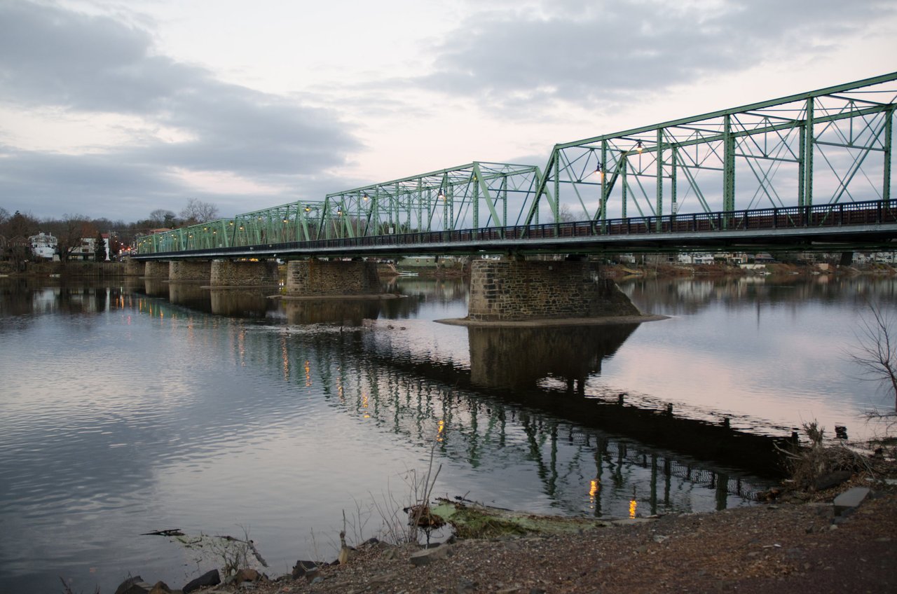
The loops depend on getting across the river, and from Lower Makefield the easiest crossing is the Scudder Falls Shared-Use Path. The Delaware River Joint Toll Bridge Commission built it during the bridge replacement project. It runs 0.86 miles in total, including a 1,587-foot walkway on the toll bridge's upstream span, a ramp down to the Delaware Canal towpath on the Pennsylvania side and a ramp to the D&R Feeder Canal towpath in Ewing. A separate pedestrian bridge carries walkers and cyclists over the Delaware Canal itself.
The Commission runs 20 bridges, and Scudder Falls is the only one where cyclists can ride across without dismounting. Fifteen of its bridges have some kind of pedestrian access, but on those walkways cyclists have to get off and walk. The Scudder Falls walkways and ramps are 10 feet wide. For a rider leaving from Yardley, that is the difference between a loop you can ride the whole way and one where you walk your bike across a river.
Along the way there are four scenic overlooks on the walkway and ramps. On the Pennsylvania side, an interpretive display holds a granite block and a bearing from the first Scudder Falls Bridge, which was built in 1959 and taken out of service in 2019. The Commission sets a 10-mph limit for cyclists on the path, and the canal towpaths are open dawn to dusk.
The Friends name two southern loops. One runs between Washington Crossing, Pennsylvania, and Washington Crossing, New Jersey. The other goes from Lower Makefield down to Morrisville and comes back to Pennsylvania along the New Jersey side through Trenton. The upriver loops come with mileages. Uhlerstown to Frenchtown is an 18.9-mile round trip, Lumberville to Bulls Island is a 7.3-mile loop, and Centre Bridge to Stockton through New Hope and Lambertville is a 7.1-mile loop. The newsletter gives no mileage for the southern loops, so map your own before heading out.
These stops near Yardley are the ones to know:
Stop | Location | What's there |
|---|---|---|
Scudder Falls park-n-ride | Off Woodside Road near Taylorsville Road, Lower Makefield | 127 parking spaces, paths to the 1799 House and canal bridge |
1799 House trailhead | Next to the Pennsylvania towpath at Scudder Falls | Restrooms, accessible ramp, bike rack, benches, bike repair station |
Black Rock Road | Lower Makefield | Restrooms |
Calhoun Street Bridge | Morrisville | Restrooms |
Washington Crossing Park | North and south sections | Restrooms, bike repair stations by the Thompson-Neely Homestead and the Visitor Center |
The repair stations stock hex keys, wrenches, tire levers and a universal air pump. For the full list of access points, the Friends publish a Delaware Canal Landmark and Mileage Chart on their website, under the Visit/The Towpath Trail tab.
One caution about Scudder Falls: the Commission's most recent closure schedule for the walkway covered resurfacing work in fall 2025. I found no 2026 notice either way, so check the Commission's site before a long ride if you plan to cross there.
On the towpath you share the trail with bikes. Five Mile Woods Preserve, at 1305 Big Oak Road near the Kohl's shopping center, does not allow bikes, pets or collecting of any kind. Lower Makefield Township manages the 300-acre preserve, which is open dawn to dusk.
The newest feature is an 800-foot accessible boardwalk that passes through a wildflower meadow, woodland and wetland. The rest of the preserve's trails have uneven ground, and the township recommends sturdy shoes that can handle mud. The preserve also sits on the Fall Line, where the Atlantic Coastal Plain meets the Piedmont. With questions, you can reach Preserve Naturalist John Heilferty at [email protected].
Several of these events are within a short drive of the river loops.
The Locktender's House complex itself got some work this year. Volunteers painted the old concession building white, cleared weeds and vines from the street-side slope and replanted the Locktender's Garden with native perennials.
If you see people in hip waders sampling the canal, they are with AKRF/Stroud Water Resource Center, the firm hired by the Friends, the nonprofit DC21 and DCNR. They are studying the fish, amphibians, insects and plants that live in the canal. The Friends expect results in early 2027 and plan to start removing invasive plants in early spring, once DCNR approves. Board president Brett Webber told the newsletter that the first removal section is planned between Centre Bridge and Lock 11, and that the study's methods will guide later work along the rest of the canal.
A loop that ends in the borough can finish at Cookies N' Cream, 175 South Main Street. According to Patch, it opened this summer with gourmet cookies, milkshakes, sundaes and vegan and gluten-free options. A few doors away, The Commonplace Reader sits at 49 South Main Street.
I pay attention to the places that shape daily routines here, from the Scudder Falls trailhead to Lake Afton. If you're thinking about how life near the river fits your plans, whether that means staying, upsizing or settling into Yardley for the first time, I'm glad to talk it through. Let's Connect.
For more Bucks County real estate tips, follow me on TikTok @dennismartinrealtor, Instagram @dmexpertrealty, and Facebook at Dennis Martin eXp Realty.
DM me for details, or visit dennismartinrealtor.com.
Dennis Martin, REALTOR® | eXp Realty, LLC
Cell 215-913-0711
Office 888-397-7352
Stay up to date on the latest real estate trends.
Ready for what's next? Work with Dennis Martin for a real estate experience centered on your goals, your timeline, and your vision.